
Project Overview
Extreme sea levels result from the combined effects of a range of factors including astronomical tides, long-term sea-level variability, storm surges due to pressure and wind, and wave breaking processes . In order to protect life and property coastal planners and emergency managers require accurate estimates of flood risk. Providing reliable predictions of extreme sea levels for this purpose represents a significant challenge due to the range of complex processes that vary from beach to beach, town to town, and state to state around the entire Australian continent. With funding from the Bushfire and Natural Hazard CRC, the University of Western Australia Coastal Oceanography Group has developed a 59 year hind cast of sea levels for 1958-2016 using an advanced, high-resolution (in the coastal zone ~100m) 3D finite element hydrodynamic model (SCHISM) for the entire Australian coastline. From these data, extreme value statistics were used to calculate extreme sea level probabilities at 1 km resolution around Australia.
A document summarising the numerical model is available here.
A detailed website userguide is available here.
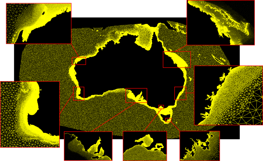
The SCHISM model unstructured mesh grid resolved fine scale features at the coast for all of Australia including islands.